Remote sensing
Spectral remote sensing for hyperspectral imagery and multispectral imagery analysis


Spectral remote sensing for hyperspectral imagery and multispectral imagery analysis
Multispectral remote sensing involves the acquisition of visible, near infrared, and short-wave infrared images in several broad wavelength bands.
Different materials reflect and absorb differently at different wavelengths. As such, it is possible to differentiate among materials by their spectral reflectance signatures as observed in these remotely sensed images, whereas direct identification is usually not possible.
Hyperspectral imaging systems acquire images in over one hundred contiguous spectral bands. While multispectral imagery is useful to discriminate land surface features and landscape patterns, hyperspectral imagery allows for the identification and characterization of materials. In addition to mapping the distribution of materials, an assessment of individual pixels is often useful for detecting unique objects in the scene.
Hyperspectral sensors pose an advantage over multispectral sensors in their ability to identify and quantify molecular absorption. The high spectral resolution of a hyperspectral imager allows for detection, identification and quantification of surface materials, as well as inferring biological and chemical processes.
Well-developed scientific application areas include geology and mineral exploration; forestry; marine, coastal zone, inland waters and wetlands; agriculture; ecology; urban; snow and ice; and atmosphere. There are also numerous military applications in camouflage, littoral zone mapping, and landmine detection
For these applications, ground truth signatures collected in the field and indexed in spectral libraries are critical for many methods of analysis. While image processing packages often include basic spectral libraries, application distinct libraries containing spectra of the specific materials occurring in the target field area greatly improves the accuracy of generated interpretations. Spectra of vegetation are influenced by such a wide range of environmental conditions that it makes it difficult to adequately represent this variability without the collection of site-specific field spectra.
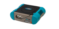
The Gold Standard in Field Spectroradiometers
FieldSpec is the market leading spectroradiometer which scientists worldwide rely on to address a wide range of applications in the natural environment.
It has the performance to analyze a wide range of remote sensing imagery that translates measurements into instant feedback.
The field measurements performed by FieldSpec maximize information derived from satellite, aircraft, and drone imagery.
The intuitive user interface allows you to easily configure and control the instrument to make the measurements you need.
The Gold Standard in Field Spectroradiometers